louis Clark TrAIL, Thetis Lake Regional Park |

|
Thetis Lake Regional Park has some very well known trails, the Upper and Lower Thetis Lake Trails. However, the park has more to offer for those willing to work a little harder. Out and around the larger paths are a series of small trails which weave there way through the densely mossed, and gorgeously green forest. It this option we chose for our day trip, the Louis Clark Trail, and we were so happy we did. This hike can be best described as a DIY hike, almost like a choose your adventure book, with a lot of opportunities to say 'right or left?' or 'up or down.'
Don't miss the larger trail though in an effort to keep away from others, circling the lakes around the West side on your way out offers some very nice waterside strolling before heading home.
Don't miss the larger trail though in an effort to keep away from others, circling the lakes around the West side on your way out offers some very nice waterside strolling before heading home.
Location
Thetis Lake is located 20 minutes outside of Victoria, right off Hwy 1. From the main parking lot, walking toward the trail head and signs for the beach, there is a map board showing the possible trails. Be warned, this map makes the trails look simple and clear, but the trails that are off of the main large paths toward the beach are small and split often. Take note of the names of major points on the map as well as the general layout of trails; this will help you navigate the park if you get far from the large pathway. Don’t panic though, you cannot get lost if you stay on a trail, the park is not that large, so just take your time exploring.
On occasion, despite feeling isolated, this trail does run very close to some private residences. Their presence isn't looming, more like surprising because you thought you were further out of the city than you are.
Difficulty
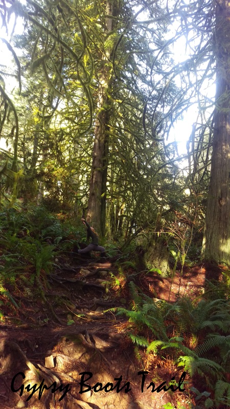
The Louis Clark Trail can be described as moderately difficult. There were sections that were slightly steep and the pathway was obstructed by rocks and roots.
There are plenty of more accessible and easier options in this park by stay on the larger wider lakeside trails.
The Louis Clark Trail can be described as moderately difficult. There were sections that were slightly steep and the pathway was obstructed by rocks and roots.
There are plenty of more accessible and easier options in this park by stay on the larger wider lakeside trails.
The Path
This park has a variety of path types available for visistors. Closer to the beach is a thicker, flatter, better maintained accessible path for those with less hiking experience, small children, or limited ability. As the main path gets farther, it gets a little more difficult to navigate but is still fairly flat and wide.
The trail we used was less walked, narrow, had steep sections and many roots and rocks.
Length
We hiked for 5 hours. This allowed us to wind through the woods on the Eastern side of the lakes for 3.5 hours from the Louis Clark trailhead, along the Mackenzie Creek Trail, to Bellamy Trail. We then circled around the lakes to the West and exit at the beach.
We hiked for 5 hours. This allowed us to wind through the woods on the Eastern side of the lakes for 3.5 hours from the Louis Clark trailhead, along the Mackenzie Creek Trail, to Bellamy Trail. We then circled around the lakes to the West and exit at the beach.
Timing
We started this hike at 9am and this was a great time. We didn’t see anyone else on the Louis Clark Trail despite the park being fairly busy and the main trail having a busy collection of joggers and speed walkers.
We started this hike at 9am and this was a great time. We didn’t see anyone else on the Louis Clark Trail despite the park being fairly busy and the main trail having a busy collection of joggers and speed walkers.
Highlights
The Highlight of this hike was the amazing amount of brilliantly green moss covered trees. It felt all day like we were walking in a magical forest and occasionally like we were in a Dr.Seuss book. There was a peaceful awe about the striking presence of the forest and the completely feeling of isolation.
The Highlight of this hike was the amazing amount of brilliantly green moss covered trees. It felt all day like we were walking in a magical forest and occasionally like we were in a Dr.Seuss book. There was a peaceful awe about the striking presence of the forest and the completely feeling of isolation.
Resources
Park map |
Connector Trails |
 RSS Feed